Platform

Your underground risk, visualised.

Undermaps consolidates every piece of your underground data into a single, comprehensive Unified Utility Model.

Giving your team the full picture of your underground risk.


Your partner in defeating underground risk.

40%

40%

40%

40%

Reduction in project relocation costs

Reduction in project relocation costs

Reduction in project relocation costs

Reduction in project relocation costs

30%

30%

30%

30%

Reduction in construction and design costs

Reduction in construction and design costs

Reduction in construction and design costs

Reduction in construction and design costs

10%

10%

10%

10%

Reduction in
redesign costs

Reduction in
redesign costs

Reduction in
redesign costs

Reduction in
redesign costs

10%

10%

10%

10%

Reduction in
project delays

Reduction in
project delays

Reduction in
project delays

Reduction in
project delays

Our Partners

Explore the power of Undermaps

Explore the power of Undermaps

Explore the power of Undermaps

Explore the power of Undermaps

Unified Utility Model

Your Unified Utility Model

The Undermaps Unified Utility Model (UUM) creates a comprehensive 3D representation of underground assets by integrating all data sources and indicating confidence levels for asset locations.

Access Undermaps
Access Undermaps
Access Undermaps
Access Undermaps

Access everywhere

From field teams, to design teams and client. Access any data, anywhere, on any device.

Living Data
Living Data
Living Data
Living Data

Living Data

Dynamic, continuously improving data model that incorporates every new piece of evidence. Lose Nothing.

Reduce Risk
Reduce Risk
Reduce Risk
Reduce Risk

Reduce risks, costs and delays

At its core, Undermaps is about more than mapping data, it’s about reducing uncertainty. By revealing what lies beneath the surface with clarity and confidence, we help teams make safer decisions, avoid costly errors, and keep projects on track.

Digital

DATA SERVICES

DATA SERVICES

DATA SERVICES

Let our expert team do all your heavy lifting.

Enquire about our data services

Existing records
Existing records
Existing records
Existing records

Existing records digitisation

Our Data Services team gather, georeference and digitise all existing utility data plans into any major format.
Utility Network Model

Utility Network Model Creation

Utilising high-fidelity satellite imagery, Reveal extract surface features and update your plans to match above-ground indications of underground assets, to create an intuitive 2D network model.
GPR Data
GPR Data
GPR Data
GPR Data

GPR Processing

Got some extra data? Let our expert data processing team take care of it, so you can focus on the things that matter.
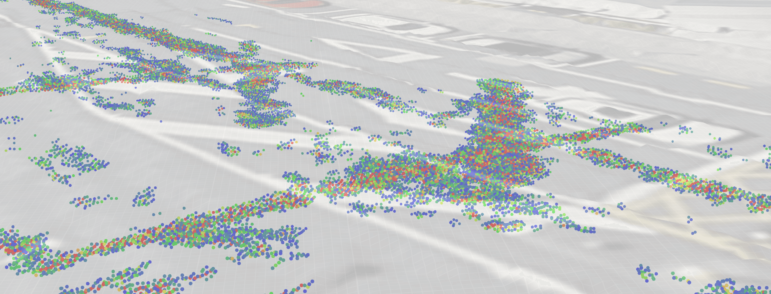
GPR pointcloud
GPR pointcloud
GPR pointcloud
GPR pointcloud

Underdots

Underdots is a fully-automated data processing service that turns raw multi-channel GPR data into actionable insights.
Data services
Data services

Underdots is a fully-automated data processing service that turns raw ground-penetrating radar data into actionable insights.

Underdots is a fully-automated data processing service that turns raw ground-penetrating radar data into actionable insights.

Underdots is a fully-automated data processing service that turns raw multi-channel ground-penetrating radar data into actionable insights.

Agonstic

Underdots is compatible with all major multi-channel GPR systems.

Fast

Get insights in hours, not weeks. Through Underdots automated processes, you get more value from your investigations budget, save time and reduce risk.

Deliverable, anywhere

Underdots can output into SEG-Y, 3DR and GeoTIFF files, meaning your data is ready for your environment, no matter the platform.

Testimonials

Don't take our word for it

Don't take our word for it

Don't take our word for it

The data Reveal has available enabled us to plan for emergency works in an unprecedented way. We were able to undertake the works within the timeframe without impacting the city; avoiding significant cost overruns​.

Zac Jordan

Principal Advisor Resilience, Wellington City Council

The data Reveal has available enabled us to plan for emergency works in an unprecedented way. We were able to undertake the works within the timeframe without impacting the city; avoiding significant cost overruns​.

Zac Jordan

Principal Advisor Resilience, Wellington City Council

The data Reveal has available enabled us to plan for emergency works in an unprecedented way. We were able to undertake the works within the timeframe without impacting the city; avoiding significant cost overruns​.

Zac Jordan

Principal Advisor Resilience, Wellington City Council

The data Reveal has available enabled us to plan for emergency works in an unprecedented way. We were able to undertake the works within the timeframe without impacting the city; avoiding significant cost overruns​.

Zac Jordan

Principal Advisor Resilience, Wellington City Council