Burton Contractors
Ingest
Australia
How Burton Contractors combined BYDA plans for a major Sydney roading project, saving engineering time and labour costs.
Project results · Burton Contractors
30
Engineering hours saved
$5K
Labour cost saved
7.67
Hectares of BYDA dials digitised
The challenge
Burton Contractors needed to understand underground utility risk on a major Sydney roading project fast, and without burning two weeks of engineering time stitching PDFs together by hand.
The solution
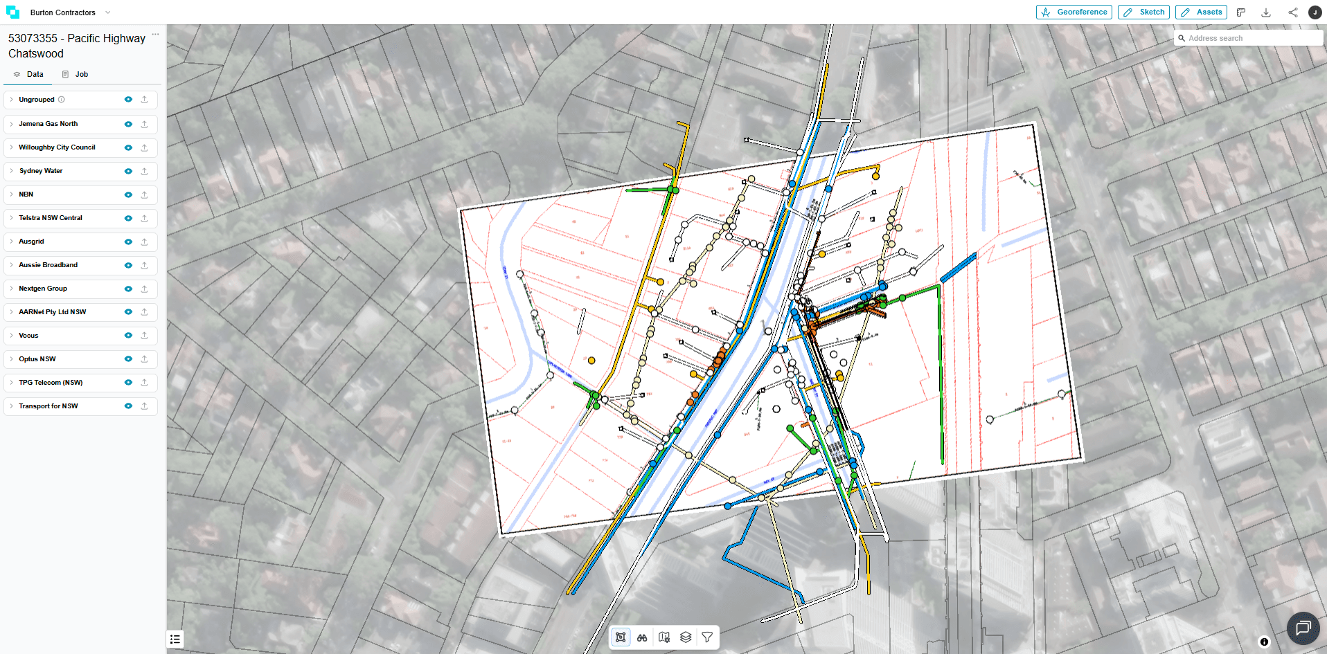
Using Undermaps Ingest, they turned a stack of BYDA dial responses into a single, accurate, georeferenced map in a fraction of the time and cost.
Undermaps Ingest uses AI to turn BYDA .zip enquiry responses into one accurate, overlaid digital view. Every utility is cleanly classified, georeferenced and instantly searchable from any device, on site or in the office. What used to take an engineer up to two weeks of manual placement and tracing now takes hours. Replace email-based responses and PDFs with a single, interactive utility map.
Replace days of manual PDF stitching with an automated, georeferenced map
Every utility classified, searchable and accessible from site or office
Hours of engineering time and thousands in labour cost reclaimed per project
A clear, shared view that lets teams collaborate, interrogate and substantiate planning decisions.
— Chris Burton, Director, Burton Contractors